Hike the Appalachian Trail
More than a quarter of the famous Appalachian Trail's 2,200 miles (3,500 km) are found in Maryland and Virginia, USA. Conquer as few or as many sections as you please on these hiking trails that weave through fern-carpeted forests and lead to waterfalls and mountain overlooks.
More than a quarter of the famous Appalachian Trail's 2,200 miles (3,500 km) are found in Maryland and Virginia, USA. Conquer as few or as many sections as you please on these hiking trails that weave through fern-carpeted forests and lead to waterfalls and mountain overlooks.
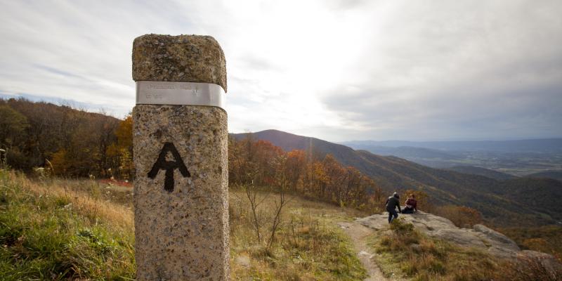
The Appalachian Trail (often called the AT) runs from the state of Georgia in the American South to Maine — the country’s most northeastern state. Nearly 580 miles (932 km) of the route are nestled in the scenic beauty of the Capital Region, winding through US national parks and state parks, offering opportunities to explore small towns. The footpath is so beloved, it draws nearly 3 million visitors a year from around the world.
Whether you’re interested in a multi-day trek or simply want to enjoy a day hike, don’t miss a chance to explore this storied trail. Here are some easy-to-reach Appalachian Trail access points, organized north to south.
Appalachian Trail Hikes in Maryland, USA
Maryland lays claim to approximately 50 miles (81 km) of the AT and is known for offering some of the flattest and gentlest sections of the trail. Your travels will take you through state parks, past historical markers and to scenic overlooks.
Washington Monument State Park
Distance: 6.3 miles (10.1 km) out and back
Nearest town: Boonsboro
This section of the Appalachian Trail climbs 1,164 feet to the top of South Mountain in Washington Monument State Park. Visit the site of the first monument dedicated to America’s first president, George Washington, and soak up the views of distant towns and peaks. Autumn is an especially lovely time to visit, as the brilliant golds and reds of hardwood trees blaze across the horizon.
Off the trail: Stop by the Boonsborough Museum of History to learn more about the area and to check out historical artefacts related to George Washington and the American Civil War Battle of South Mountain.
Gathland State Park
Distance: 6.9 miles (11.1 km) point to point
Nearest towns: Weverton at the southern start and Burkittsville at the northern terminus
Start your trek at the Weverton Cliffs — stunning quartzite formations that offer sweeping vistas of the Potomac River from their tops. Your northward journey takes you through dense forestland as the trail leads to the War Correspondents Memorial Arch at Gathland State Park. Originally the mountain home of American Civil War journalist George Alfred Townsend, the park features restored buildings and a museum with artefacts from Townsend’s life and the Battle of South Mountain.
Off the trail: Extend your trip by heading 1.3 miles (2 km) south from Weverton Cliffs to view Lockhouse 31 on the Chesapeake & Ohio Canal towpath. Lockhouses — homes of the people who raised and lowered the canal waters — dot this historical freight route that hugs the Potomac River for nearly 185 miles from Washington, DC to Cumberland, Maryland, USA.
Black Rock & Annapolis Rock
Distance: 7.3 miles (11.7 km) out and back
Nearest town: Myersville
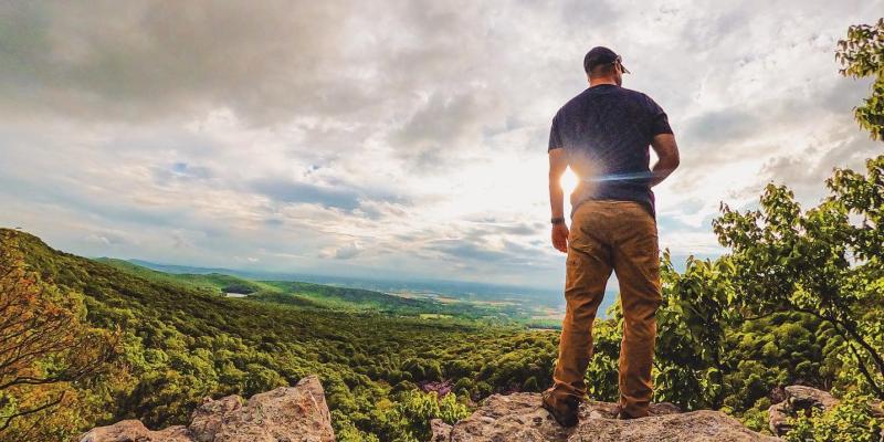
This popular trail is a moderately challenging hike ideal for trail running or day hikes, and the area offers campsites for overnight stays as well. Stroll the footpath lined with moss-covered logs as thickets of trees shade your journey. The lookout points at both Black Rock and Annapolis Rock open up to awe-inspiring views of Cumberland Valley and Greenbrier Lake.
Off the trail: Stop by Karen’s Kountry Store at South Mountain Creamery in nearby Middletown, Maryland, USA. Treat yourself to ice-cream cones while watching the cows or book a time to help feed the calves.
Appalachian Trail Hikes in Virginia, USA
Virginia is home to 544 miles (875.5 km) of the Appalachian Trail — the most of any state in America. See wild ponies, explore charming communities and stop into the AT visitor centre in Damascus, Virginia to learn more about the trail.
Humpback Rocks Loop
Distance: 4.2 miles (6.8 km) loop
Nearest town: Lyndhurst
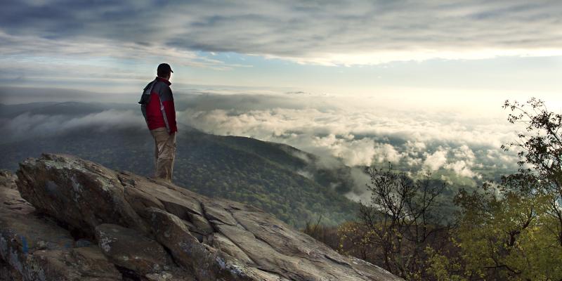
With easy access from the Blue Ridge Parkway, the hike to Humpback Rocks in Virginia is pretty popular, so it’s likely you’ll encounter fellow nature enthusiasts along the way. While the climb to the top is challenging, the payoff is worth it, with views of the rolling, emerald-green Appalachian Mountains and cloud-streaked bluebird-coloured skies. There are also benches along the way if you need to catch your breath.
Off the trail: Don't miss the farm museum at the visitors' centre located at milepost 5.8 on the Blue Ridge Parkway. (Tip: This is also a good place to park if the lot at the trailhead is full.)
Cole/Cold Mountain
Distance: 6 miles (9.7 km) loop
Nearest town: Montebello
Cole Mountain (sometimes referred to as “Cold Mountain”) in central Virginia is a moderate hike that slices through dense, shaded woods as well as wildflower-dotted meadows on the way to a summit boasting panoramas of the surrounding valley. Stop at the Cow Camp Gap shelter, where you can find a logbook in which Appalachian Trail thru-hikers and backpackers leave notes about their journeys.
Off the trail: Stretch your legs or enjoy a picnic at the Montebello State Fish Hatchery, where you can watch a variety of trout and chat with the knowledgeable staff.
McAfee Knob
Distance: 7.8 miles (12.6 km) out and back
Nearest town: Salem
One of the most-photographed sections of the AT, the McAfee Knob trail climbs 1,811 feet to a thick slabs of rock that overhang the valley below. The clearing at the trail’s high point opens up to views of the gentle swells of the Blue Ridge Mountains — a subrange of the Appalachians named for the bluish haze that hovers over their summits. (The haze is the natural result of regional trees emitting chemicals that filter the sun’s light in a way that makes the blue stand out.)
Off the trail: Unwind after your hike with a grapefruit IPA or rich porter at Parkway Brewing Company in Salem, Virginia. Keep an eye on their calendar for live music and a rotating selection of food vans.
Grayson Highlands State Park
Distance: 6.9 miles (11.1 km) out and back
Nearest town: Mouth of Wilson
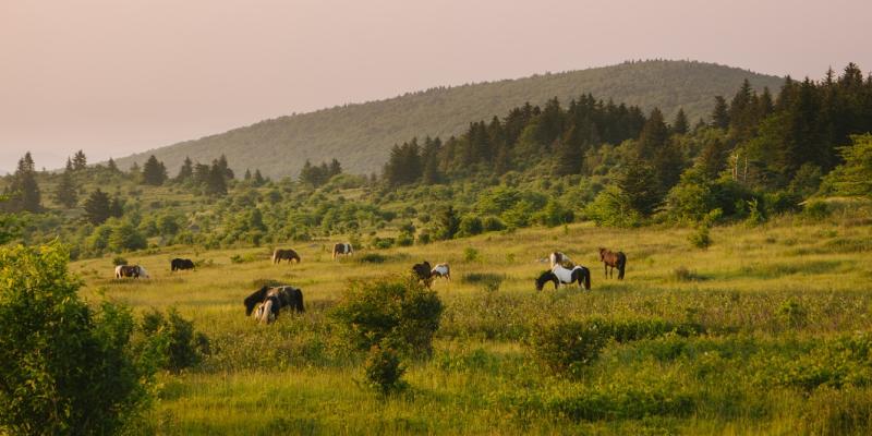
Arguably one of the most scenic sections of this famous footpath carves its way through Grayson Highlands State Park. The park is known for its population of wild ponies, which you're likely to see during your adventure. Follow the Rhododendron Gap and Appalachian trails, keeping an eye out for the shaggy ponies as the trail crests Wilburn Ridge — but make sure you stop to soak in the scenery, too.
Off the trail: Stop in the Corner Market and Cafe to satisfy post-hike hunger with the flavours of the American South. Dishes range from biscuits (somewhat similar to savoury scones) with sausage gravy to hamburgers and ice cream.
Find more outdoor adventures in Washington, DC, Maryland and Virginia, USA:
Explore national parks in America’s Capital Region.
Check out state parks in Maryland and Virginia, USA.
Discover more waist to enjoy the great outdoors in the Capital Region.
Connect with a tour operator to help plan your American holiday.


